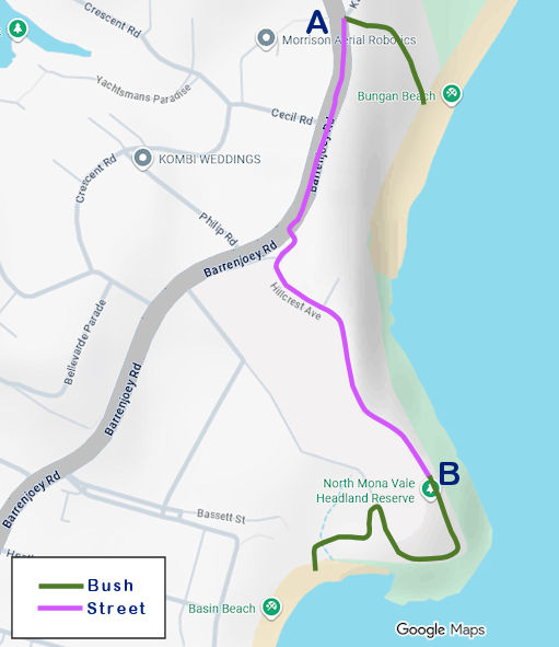
Bungan to Basin Track
This short coastal walk is an easy, family-friendly trail of less than 2 km one way. It has sections on streets, but even there, it's possible to have beautiful views of the ocean.
Except for the very beginning, the route uses a well-maintained path through grassy areas and bushland.
The walk crosses the North Mona Vale Headland Reserve, looping around the headland before reaching Basin Beach. Along the way, it offers views over Bungan Beach to the north and the sandstone cliffs that define this part of the coastline.
At the top of the headland, the track opens into a broad grassy area with wide views of the Pacific Ocean, stretching south towards Mona Vale Beach and north along the coast. It is also a vantage point for whale watching during migration season.
The headland was known as Bushrangers Hill, because bushrangers (escaped convicts and outlaws) used it in the 19th century as a lookout for approaching authorities or potential targets.
The walk then descends towards Basin Beach, becoming more sheltered and partially shaded, with views continuing towards Basin Beach, Mona Vale and beyond.
Directions
- The walk begins on a poorly signed bush track that starts approximately in the middle of Basin Beach, connecting the sand to local streets before reaching Barrenjoey Road.
- This sandy, shaded path holds a pleasant surprise midway: a rustic public shower.
- Upon reaching Barrenjoey Road (point A on the map), turn left and follow the pathway to Hillcrest Avenue, which leads to the North Mona Vale Headland Reserve (point B).
- As you walk this section, peek between the coastal backyards for glimpses of the ocean.
- The reserve offers an easy, peaceful stroll with sweeping views.
- At the far end of the grass, look for sandy steps descending into the bush. This trail loops around the headland and emerges at the end of Grandview Parade.
- From here, a path to your left winds down the hill to the sands of Basin Beach.
- To continue toward Mona Vale, you have two options: walk along the beach sand or, if you prefer firmer ground, take the trail to your right that leads to Surfview Road and follow it southward.
Walk Details
- Australian Walking Track Grading: Grade 2 (easy)
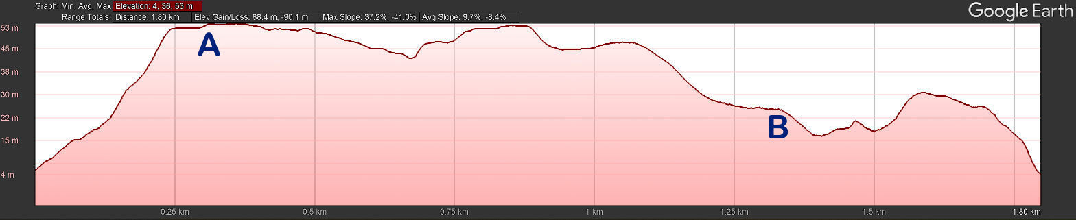
- Total length: Approx. 1.8 km
- Time: 40 min - leisurely pace, with photo stops
- Highest point: 53 m
- Steepest ascent: 37 %
- Steepest descent: 41 %